Showing posts with label Northern Ontario. Show all posts

Friday, September 3, 2010

Schrieber to Blind River

Day 29 – Friday September 3, 2010

Kilometres: 675.6

Time: eight and a half hours (ride time)

Weather:

Scheiber: Heavy rain, 13 C at 9 AM

Blind River: Cloudy with passing showers, 20 C at 6 PM

Yet another day of rain and cold. I woke up in the middle of the night because the rain on the motel’s roof was so loud.. The parking lot was flooded when I looked outside this morning. (See pic.)

In an attempt to drain the water, the hotel plugged in a water pump, that is what the electrical cord in the pic is for. I turned on the Internet and looked at the forecast. More heavy rain and the temperature will drop to 8 C by the afternoon. Hmmm, how fast can I get out of Schrieber? I packed up the bike, had a coffee and was gone in half an hour.

It didn’t long before the showers turned into heavy rain and I had to slow down just to see the road ahead of me. The one good thing is that there aren’t as many trucks on the road today. I guess all the truckers have gone home for the Labour Day weekend.

Nonetheless, my two favourite rides in Ontario were not nearly as much fun as they could have been because at times it was just too dangerous to go above 80 kph on a road that I would normally do about 100.

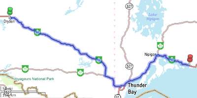
I stopped in Wawa for gas and a quick lunch at Tim Hortons. There isn’t any gas between Wawa and Sault Ste. Marie, which is about 230 kilometres to the south. My bike can go about 300 before dipping into the reserve, but I really like to play it safe so I try to fuel up by 225, just as I had to with my old bike.

On a motorbike, the rider can very quickly feel the change in weather. Today I knew immediately when I finally broke through the cold front. Unless you’ve experienced it, you would think I’m exaggerating when I say that the change from cold to warm is almost instantaneous. It’s like going indoors to a warm house after being out in the cool fall weather. My thermometer on the bike shot up a few degrees really quickly, and my hands didn’t feel as cold. The downside to this particular change in weather was that the wind picked up.

I’d just reached Agawa when the change in weather occurred. For those not familiar with the region, it is right on the eastern shore of Lake Superior. The wind came rushing in straight off the lake, which meant it was cold and gusty. The gusts at times were strong enough to push my bike and I had to fight against it to stay in the blocking position, which has now turned into almost the centre of the lane. I quickly figured out that the trees were blocking the wind from the lake, so when there wasn’t a line of trees, I braced for a strong guest.

This stretch of road is in a provincial park. If you recall from my blog posting from day two of my Big Trip, I really didn’t know how to describe the landscape. After seeing much of Canada, the only place I can compare the park to is the foothills of the Rocky Mountains west of Rocky Mountain House. Those foothills went on forever when compared to the foothills leading into the Crownest Pass, and into Jasper.

This is also where I saw my second 18 wheeler overturned. The first one on my way out west and happened between Terrance Bay and Marathon. It had just occurred because the OPP went whizzing by me to get to the scene. By the way,on my way home I noticed that the that truck is still there and has yellow police tape around it. You’d think that someone, such at MTO or the trucking company, would have removed it. Anyway, I saw the second overturned truck today. It was an Atlas Moving truck. I don’t know if it was hit by a gust of wind, but it had cross over into the oncoming traffic and gone into the ditch. Some poor family’s household goods were thrown out of the truck. I saw a mattress and some furniture in the ditch or halfway out the back door of the truck. I really felt sorry for these people. A couple of other 18 wheelers were there. A couple of people were clearing up the household contents and loading them into another truck.

I was soon in Sault Ste. Marie, where I filled up with gas and immediately left. The weather had pushed me behind schedule. It was almost 4:30, which was much later than I had expected to arrive in the Soo.

I rode from Sault Ste. Marie to Blind River in about an hour and a half. It rained lightly a couple of times, the wind continued to blow, and the clouds always looked threatening.

Blind River is tiny. I pulled into the hotel and almost immediately asked about food, after noticing that the motel doesn’t have a restaurant. I’d noticed the Tim Hortons, but I can’t do Timmy’s twice in one day. The guy pointed to a street opposite the motel and said, “That’s our downtown.” It looked about two blocks long and there wasn’t a person in sight.

I unpacked the bike and walked, in the rain (surprise) to downtown, which was mostly closed. I noticed only three places open, a pizza parlous, a bar, and the liquor store. Now, I may be wrong, but I usually have a good sense for this sort of thing. There was no way I was going to go in that bar. It just looked like trouble. I kept walking and went into the LCBO, picked up a bottle of Italian red and then went to the pizza parlour.

Back at my motel room I taste tested the wine and pizza. The leftover pizza will be breakfast in the morning (I wonder how cold pizza and coffee go together?)

This is my last night on the road and I am thankful for it only because I just want to be warm and for the rain to stop. I haven’t seen the sun since last Tuesday in the Okanagan Valley.

Thursday, September 2, 2010

Dryden to Scheiber

Day 28 - Thursday September 2, 2010

Kilometres: 584.2
Time: seven and a quarter hours (ride time)

Weather:
Dryden: Rain, 17 C at 9 AM
Upsala: Heavy rain, 12 C at 12:30
Schieber: Rain 16 C at 5 PM

I need only one word to describe today's ride: wet. If I were asked for another adjective, I'd say, "cold."

It rained all day from start to finish. What really bothered me was the temperature fluctuations. East of Upsala, it went down to 10 C and hovered there for too long. I was just frozen by the time I pulled into Thunder Bay around 2 PM.

I have now ridden on the most horrible roads imaginable. From Kekabeka Falls, which is about 15 km west of Thunder Bay, I rode on scraped, grooved pavement, gravel, and then for about half a kilometre I rode on dirt. Well, I'm sure it started out as dirt, but with all the rain it turned to mud. It was about 10 kilometres of hellish riding. To make matter even more interesting, it was one lane only - both east and west bound traffic were using the same lane. Groan. Signal people let traffic through at a snail's pace. Unfortunately, when the signal person says, "Go," the front car takes off and leaves me behind to hold up traffic. I can't drive too slowly or the bike will get caught in the groves and go over. If I drive to quickly, the front end starts to shake uncontrollably. I'm usually pretty good at 60 kph, but the cars behind me think it is way too slow.

The only good thing about all this is that if I do have an unplanned dismount, the construction people will probably pick my bike up for me as I can't lift the thing by myself. They don't want to hold up traffic on the account of an upturned motorcycle.

I went passed the Eastern/Central time zone marker, but I didn't stop. There was just no point in stopping because it was raining so hard. The same was true for the Terry Fox monument. It's also a scenic lookout, but I really couldn't see more than a couple of kilometres ahead on the road, never mind looking at Lake Superior.

I arrived in Scheiber, cold, and hungry. At least I was dry. Most of my stuff is soaked. I've even propped my helmet up on the motel's ice bucket so I can get some warm air under it to dry off the padding. I'm sure it will take a few days to dry out everything in my luggage once I get home.

Speaking of warm, I'm finally at a hotel where I have control of the heat. This is the first time since Edmonton that I've been warm. I hear that Toronto is still having a bit of heat wave. I hope it's there when I return home in a couple of days.

I have one more stop, in Blind River, and then the following night I will be home. I hope the weather improves for tomorrow's ride as I will be riding two of my favourite Ontario highway sections. Currently, Scheiber and the surrounding areas are under a heavy rain fall warning. I'm keeping my fingers crossed that the weather will finally co-operate for the final two days of the trip.

Finally, today I passed the 10,000 kilometre mark on the trip. I think the bike deserves a good wash, an oil change, and a new air filter after such a long ride in 28 days.

Wednesday, September 1, 2010

Winnipeg to Dryden

Day 27 - Wednesday September 1, 2010

Kilometres: 355.0

Time: four and a half hours (ride time)

Weather:
Winnipeg: Mostly cloudy, 16 C at 10 AM
Dryden: Scattered clouds, 23 C at 3 PM

It was a rather uneventful ride today. I retraced the roads I ridden only a few weeks ago. There is more construction, though, which is challenging. In one section just east of Kenora, there was about 7 kilometres of scraped pavement, which is really dangerous for motorcyclist if the grooved pavement is deep. The wheels tend to follow the grooves and take control of the direction of the bike. Fortunately, only a portion of it was deep. Another part of the same construction zone reduced the road to gravel. It's not as bad as mud, but there were a few white-knuckled moments.

I know I'm back in Ontario when I have to share the road with dangerous drivers who should never have been issued a licence. So there I am, trying to negotiate a gravel road (that is a highway) and I'm doing the posted construction zone speed limit of 60 kph. I'm following good motorcycle safety procedure by riding in the blocking position, which is roughly a metre or so to the right of the centre line. Some idiot decided that I'm not going fast enough and that I shouldn't impede his speed. He drove on the gravel shoulder to pass me on the right.

This is the fourth time this has happened to me this summer. One idiot woman decided to pass me (in a school zone outside of the Toronto police college) by driving in the bicycle lane. Only in Ontario has this happened to me.

The best drivers are in Saskatchewan. They pull over and slow down to let you pass. They'll let you merge with traffic without trying to push your off the road. They follow the rules the road. Drivers in Alberta are all just speed freaks. The posted highway speed is 110, but to keep up with traffic you have to do about 130. Some go much faster than that. Red light runners are few and far between in the Prairies. I saw mostly yellow light runners in BC, but not one red light runner. I felt really out of place when I ran a yellow in Winnipeg. I was the only who did it.

After driving in many major cities in five provinces in the last month, I think Ontario drivers are horrible and GTA/Toronto drivers are downright deadly. Now I know why insurance rates are so high into Toronto.

On to a better subject, though. The weather finally improved ... but not for long. When I packed up the bike this morning it was sunny. Fifteen minutes later, it was cloudy and rain threatened. Fortunately, it didn't catch up with me. It even started to warm up. By the time I arrived in Kenora, I changed into my summer riding gloves and removed my polar fleece jacket.

It was a short ride today. I guess I planned it that way for a reason, but I can't figure out what the heck I was thinking. I finished today a bit after 3 PM, but I could have gone for another three hours without a problem. I guess there isn't a whole lot between here and Thunder Bay, which is just over 300 kilometres away.

The weatherman is calling for rain starting tonight and going into tomorrow. There is a possibility of thunderstorms in the afternoon, so I will get an early start.

I have an eight hour ride ahead of me tomorrow so I'm hoping that the forecast is wrong.

Monday, August 9, 2010

Kenora to Winnipeg

Day 4 – August 9, 2010 – Kenora to Winnipeg

Time: two hours and 15 minutes (includes one 5-minute break)

Kilometres: 270.3

Weather:

Kenora: Sunny, warm, 28 C at 10AM

Winnipeg: Sunny, hot, 38 C at 1:30 PM

Well, I beat the storm. In fact, I’ve been in the city for about two hours and the clouds are just starting to roll in.

I pulled out of Kenora around 10:15. I followed the T’Can (hwy 17) through town where I came to a real roundabout. The sign was just like the ones I’d seen in England. I’ve only found one roundabout in Toronto and thankfully it is not a busy intersection as there are no signs telling drivers how to use it properly. If you’re looking for that roundabout it is on Windermere north of The Queensway. Anyway, I knew proper roundabout etiquette (thanks, Doreen) but I was the only one on the road so know one saw the proper signalling and lane changing.

The ride through the remainder of Ontario was the same as the day before: a few hills and lots of forest. The road wasn’t very twisty, but it was interesting enough.

I quickly came to the Ontario-Manitoba border. Ontario had a tourist information kiosk for those entering the province. The “Welcome to Manitoba” was upon me very quickly. In fact, I didn’t even have enough time to pull over for a photo-op – especially as I had a car right behind who would not have appreciated my quick braking and pulling over.

Just inside the provincial border is a Manitoba info centre. (Here’s a pic of the sign.) My main reason for pulling into to was to push my luggage back onto the seat. It had slowly been tilting over as I road and I was afraid that if I leaned too far over it would be hanging on only by the python lock. I also made some Kool-Aid from the singles packages but quickly discovered that it leaves a very chemical aftertaste. I’ll stick the make-at-home version and not the singles.

It took awhile for the trees to slowing change from the normal jack pine, cedar, evergreens, and birch. It’s not that the species change, although I think I saw some poplar trees, the height and abundance slowly did. Ninety-four kilometres into the province, the forest disappeared into cropland. For most of the 94 km the road was nearly perfectly straight, two lanes in both directions, and divided by enough trees that I couldn’t see the opposing traffic. I guess the trees really help stop the drifting and blowing snow in the winter.

The posted speed limit is 100 km, but even though I was doing between 110 and 115, I was still one of the slowest vehicles on the road. I had a fire truck behind me most of the way and it would have run me over if I’d gone any slower.

Just passed the turnoff to Steinbach, construction forced the traffic to slow down to 60. I didn’t mind as I got a good look at the farming and the landscape. I really think that the Prairies have been given a bad reputation because of the straight roads and featureless views. The roads are straight because there are no natural features to force engineers to build around them. The rocks of the Canadian Shield are gone. I think, however, that there would be more trees, but the land has been cleared for farming. The sudden disappearance of trees did not seem natural. One second I was surrounded by tress and then next second they were all in my rear view mirror.

While I slowed for the construction area (it was about 25 km of roadwork), I looked over the landscape and I saw clumps of forest in the middle of farmland.

The weather was now getting a little hot – even for me. Again I was wearing the cooling bandana and my Gore-Tex, but as I was only doing about 60 km, I didn’t need the Gore-Tex and quickly began to overheat. To top it off, it was impossible for me to pull over as it one lane of traffic in both directions and no shoulders. I just had to literally sweat it out.

As I neared the end of the construction zone, I turned on my GPS. Before leaving the hotel in morning I had programmed it to find the quickest route to the hotel in Winnipeg. I didn’t need it to get out of Kenora, as the all I had to do was stay on the T’Can. The GPS did its job perfectly. I rode through the hotel’s parking lot at just after 12:30. I had time to kill as check in isn’t until 3PM. I pulled over and again adjusted the luggage and headed north along Main Street.

First I crossed over the Red River and the over the Assiniboine River. I was in the heart of The Peg. To my right I saw an almost familiar building. It was Union Station. It looks like a smaller version of the one in Toronto. I’d guess that it’s about half the length, but it is constructed in the same style – with the columns and the clock and the windows.

I was stopped at the lights and Portage and Main. My thermometer registered and warm 38 C. On the southeast corner is the Bank of Montreal. Again, it is constructed with the imposing Greek columns. On the southwest corner is a modern looking Scotiabank. Somewhere in my travels through downtown, I saw a hotel that looked similar to the Laurier in Ottawa, but again a smaller version.

I found a gas station, and filled up for $7.75. I couldn’t believe how cheap gas is compared to northern Ontario. Some places in Ontario gas was as high as $1.14/l, but usually around $1.07/l. In Winnipeg all the stations are at .93/l. I was now in the north end of the city. During my short trip through the city I had been keeping my eyes open for a place to do my laundry and also for a tattoo shop so someone could put my earring back in (I think I also have an infected one, so no earphone and iPod today). I found a place for laundry, but I think I must be in the “wrong part of town.” It had bars on the windows. I also fond a tattoo shop, but it was closed.

I turned back towards the hotel as I had passed a Tim Hortons near it. It was lunchtime. After lunch, I checked into the hotel. Again, my luggage had started to lean off the bike. To top it off, I found that one of my python locks didn’t lock anymore. Well, it comes with a three-year guarantee, but tell that to Canadian Tire (no receipt, then no return or exchange).

I pulled everything off the bike and checked into my poolside room. Well, it sounded like a good idea when I booked the room, but it is a bit noisy. Thankfully I have plenty of earplugs with me. (Here’s a pic of the pool. I just walk out the door and I can go for a swim. Perfect!)

I am currently into chocolate brownies and Australian red wine (a wonderful combination) for a snack. I’ve already done a few laps in the pool and will head into the hot tub shortly. After that, I have some problem solving to do. How do I fix my luggage problem? Tomorrow will be my best change of finding things to either stabilize the luggage or replace the damn thing.

Kenora update

Day 4 – August 9, 2010 – Kenora update

I haven’t mentioned the wildlife in any of my post. I haven’t seen anything different than what I have in Toronto. There are a lot of crows. I stopped traffic on the way out of Sault Ste. Marie because an indecisive black squirrel stopped in the middle of road about 10 metres ahead of me. I held up traffic for a few seconds and then got tired of waiting for the squirrel to do something. I loud rev of my engine brought him back from his daydreaming and he scooted off the road. I saw a chipmunk play chicken on the Trans Canada. It has gone on to tell its tale to its kids, thankfully. And finally, I saw another chipmunk at the Terry Fox monument. Oh, and the hawks are always circling above farmers’ fields, open meadows, and sometimes over the forest. I have lots of moose and deer warning signs, but not a trace of them. I guess that's a good thing, though.

After last night’s storm I had dinner and a beer at the hotel restaurant. The beer meant that I couldn’t ride for the remainder of the day, so I haven’t seen anything of Kenora.

It will be a short ride today – about two and a half hours to Winnipeg. The forecast for Winnipeg is a comfortable 32 C and severe thunderstorms this afternoon. I guess I will start off the ride with my gear covered in tarp. Yesterday I wore my Gore-Tex (because of the wind) and my cooling bandana. That wound up being the perfect balance. Right now in Kenora it’s 18 C, so I will be cold on the highway without my Gore-Tex.

Check in time at the hotel is 3 pm, but I’m sure that if I show up early, in the rain, and wearing my helmet, they will let me check in early.

Sunday, August 8, 2010

Thunder Bay to Kenora

Day three – Sunday August 8, 2010 – Thunder Bay to Kenora

Time: 6.5 hours

Kilometres: 511.5

I was so tired that I just didn’t want to get out of bed this morning. I slept a solid nine hours and really would have been happier with another hour. As it was, I didn’t drag my tired little self out of bed until 9:08. Last night I took a shower to get the grime of the road off of me, so I didn’t bother with one this morning. I quickly packed – well, I’m getting quicker, but it’s still not quick – made coffee and ate a chocolate Power Bar. I was on the road my 10:15.

It was a lot warmer than it has been for the last two days. By 10 am it was already 28 C. I didn’t feel the humidity (but then again, I rarely do), but I heard some other people complaining about it. I knew the stretch of road ahead is sparsely populated, so my plan is to gas up at every opportunity. Some of the communities up here in the north are over an hour away from each other. To be on the safe side, I get gas every 225 km, so that means if I miss a gas station out here, I may well be stranded.

I started the ride wearing just my mesh riding jacket and riding pants, but I didn’t get far before I realized that riding the highway was much colder than the temperature on my thermometer. I pulled over and put on my Gore-Tex rain pants and jacket. I left the polar fleece jacket in reserve.

The weather was bright and sunny, which was a pleasant change from the last two days. But it also presented a problem I thought I had fixed weeks ago. I had noticed that when I ride south between the hours of 11 AM and 1 PM, the sun strikes the fake chrome (a.k.a. shiny silver plastic) that surrounds my speedometer and reflex back into my eyes. I fixed the problem by bandaging all the way around the instrument panel with black electrical tape. City riding is a lot different than highway riding, because in the city I turn a lot more corners. Today I was riding straight-a-ways. And this time the sun was hitting all around my ignition and headlightds and bouncing directly into my eyes.

Just as I reached the 90th longitude, I’d had enough. This is also the time zone change from eastern to central time. It was the perfect opportunity to wrap the front of my bike in electrical tape. Here’s a pic of the 90th longitude with my bike in the background.

By now I was riding on very straight roads where I could see for kilometres ahead. And people told me the Prairies are boring to ride! After the last couple of days, this was a piece of cake and kinda monotonous. I’m really glad I have my iPod.

It was just straight roads and forest on both sides. I did notice that unlike what I’m used to in Southern Ontario, there isn’t a fence a few metres beyond the road ditch. With all the moose warning, it’s so easy for them to just wander out of the woods and away from the blackflies. So now I know that the fences are there to keep people out and not to stop the wildlife.

As I left Dryden, the landscape changed again. It was not rolling hills with farm land. I hadn’t seen rolls of hey in the field in a long time. The area reminded me very much of the farm land just north and east of Toronto; however, every now and again it becomes rocky. After an hour, the landscape changed again, this time into forest and rolling hills made of rock surrounded by swamps and lakes. (Here’s a pic. The road to the right is a gravel road that truck can turn into the check their loads. As it was gravel, I just quickly pulled over on to the hard shoulder to take the picture before quickly moving on.)

As I got closer to Kenora, the roads again had many more curves in them – some with spectacular drops into inky water. Not a place I’d like to wind up. I kept think about those poor people who built the railroad through here in 1870s. It’s all forest and rocks and swamps and bogs. I’d read once that a locomotive went off the track when the weight of it sank the tracks. The bog/swamp just swallowed it right up and it was never recovered. Before that, there was the great march out west by the Northwest Mounted Police (a.k.a. the RCMP) who took the train as far as they could and then set out on foot to Winnipeg. Having seen the landscape, I now really pity them.

With the roads much more interesting, I began paying too much attention to it and not enough to the changing weather. Very dark ominous black clouds were quickly replacing the blue sky. I didn’t have my weather alert gadget out, but I knew I was in for a pretty good storm and I didn’t want to get stuck in it.

I pulled the throttle a bit harder and tried to stay at a steady 115 kph, but I had to slow down periodically for some tight turns. I spent about 45 minutes racing the storm to the hotel. I pulled into the driveway (yippee, without getting wet) and promptly stalled the bike. I know I was red-faced inside that helmet.

As I came out from the lobby after checking in, I overheard a local say that he was just in the Canadian Tire and the power had gone out. He also said that he’s been watching the radar and we were about to get clobbered.

I rode my bike up in front of my room, and as the wind picked up, I almost literally tore everything off the bike and threw it through the doorway. The weather didn’t stop the flies. They descended on my bike. It must smell really good to them because it’s covered in bug splatter. The wind kept catching the bike cover, so I had a bit of wrestling to do to get it over the windshield. I cinched it on tight and then pulled the python lock through two grommets and the front wheel. I wasn’t inside my room for more than 10 minutes before the storm hit. The rain came down horizontally, and the thunder and lightning were continuous. I was very lucky. If I had dallied longer for lunch or stretched a bit more when I stopped for gas, I would have paid for it.

I caught up on a few emails while the rain came down and after the storm I walked across the parking lot to the hotel’s restaurant. No Guinness and no fish and chips. Well, I can’t have everything. I least I’m dry.

All in all it was a good riding day. I didn’t feel rushed like I had for the last two days, and the weather was almost perfect. And now I’m off to re-read the instructions for my weather alert radio. I’m sure the Prairies will be interesting and I want to be prepared.


Sault Ste. Marie to Thunder Bay

Day two – Saturday August 7, 2010 – Sault Ste. Marie to Thunder Bay

Time: 11 hours

Kilometres: 745.5

Diane and I parted ways first thing in the morning. I’m continuing west and she is going south into Michigan, unfortunately with a broken speedometer. For those not versed in such things, the majority of motorcycles aren’t equipped with a gas gauge. We know roughly how many kilometres our bikes can go before we have to fill up. Without a speedometer, Diane will not know how many kilometres she’s ridden so she won’t know when to fill up. I advised her to fill up every two hours to be on the safe side. I’ve crossed my fingers for her.

I think she was bit disappointed that I didn’t want to have breakfast before heading out, but it was already 9:15 and I knew I had a long ride ahead of me.

While I was packing up the bike – which is an adventure in itself – I thought it might be warm enough not to wear all four layers. I’m glad I did, thought. I was only a few kilometres up the road when I glanced down at the thermometer on my bike. It was only 12 C.

Just north of Sault Ste. Marie is some of the most wonderfully spectacular scenery I’ve ever seen. Again, it is the Canadian Shield, so there are pines, cedar and white birch trees on both sides of the road. There were continuous signs warning of the danger of moose wandering on to the roadways. While I’d love to see a moose, I don’t want to meet one on the road. Fortunately, they seem to be on the move at night, which I found surprising.

Lake Superior Provincial Park is eye candy. The area is untouched forest, and the huge rocky hills (that’s what they call them, but they look like rock was randomly punch upwards from the earth’s crust) makes this one of the gems of the Ontario. It’s spectacular. Many of them are hundreds of feet tall. I really don’t know how the trees cling to them. Checking the map, the tallest hill is over 600 metres. I know that is nothing when compared to the Rockies, but in their own right, this is beautiful scenery. I’m so looking forward to riding back through the park on my return trip.

I pulled into Wawa around 12:30 while listening to the Sex Pistols God Save the Queen. I’m not sure if punk is tunes for the road. I stopped at the Wawa Goose, which I found out is slowly rusting and the city is trying to raise money to replace it before it falls down. I finally took my first road pictures – of the goose and the Trans Canada as it leaves Wawa. I had breakfast/lunch at Tim Hortons and then gassed up the bike. I was off the road for about an hour, which did me the world of good, as I really needed the break.

Riding these long twisty roads, without any straightaways, it mentally fatiguing. I was fortunate not to have any dummy drivers trying to run up my tail pipe. I think I’ve left the idiots in the city. People here seem to know the rules of the road and actually obey them, that is except for the speed limit. The Trans Canada has a 90 km limit, but that is generally ignored. I’ve always gone 10 over the limit and I’ve never had a problem in all my years on the road. There was only one OPP car with radar, so hopefully he/she will catch the idiot doing 20 km over the limit. They are the ones that get right on my tail.

The only piece of bad news from Wawa (it means “wild goose” in Ojibwa) is that I blew out one of my ear rings. I will have to find a tattoo/piercing store in the next couple of nights to have it inserted and capped again. I don’t want to hole to even think about growing back in.

My next stop was Marathon, which was about two and a half hours away. Scenery-wise, the hills were gone and I was left with just forest.

On a side note, before I left home I read Lee Park’s book Total Control. He was a professional motorcycle track racer, and his book provides basic lessons on applying track theory to on-road riding. Like many riders, my cornering skills are lacking. This ride has given me the perfect opportunity to improve those skills and follow the nine steps of taking a corner. While I don’t always agree with approaching a winding highway with a race track mentality, many of the techniques give me much more control over the bike. I have skipped a couple of the nine steps as I’m not about to put my knee down when taking a corner. First, my floorboards would hit pavement (ouch) and secondly, if I go over that far, my engine will automatically shut off. Besides that, I’m not a racer.

Another highlight of the day was the first 45 kilomtres west of Marathon. Wow! Talk about winding roads. That was so much fun. It took a lot of concentration just to keep my eyes on the road. The scenery was similar to Lake superior Provincial Park, but with even more twists, lots of ups and downs, more giant rock hills, and so much more interesting. (Here's a pic of my bike in Marathon with Lake Superior in the background.)

Fortunately, traffic was light. At one point I pulled off on to the hard should (there weren’t many of them as most were soft) to take a picture of the road I’d just ridden. While the slop of the hill pushed my bike back (that’s a good thing), the slope of the shoulder towards the forest and ditch was too much for my bike. I couldn’t even put down the kickstand because of the slope. I hope I can find a good stop to pull over to take pictures on my return trip. The scenery was absolutely amazing.

As I pulled into Terrance Bay for gas my iPod was playing George Harrison’s Wah Wah. It would have been relly cool if I’d pulled into Wawa listening to Wah Wah. From Terrance Bay westward, I had the forest on my right and Lake Superior on my left. The rugged coastline was spectacular. It was very windy again today. There were white caps on the lake and the surf was pounding in over the rocks. I was lucky and found a spot to pull over and take a couple of pics of the lake. Strangely, my stop was one of the few places where there was a bit of sand and not outcrops of rocks. Just think Group of Seven and you’ll get the idea.

Just east of Thunder Bay I pulled over at the Terry Fox monument. Now here is the weirdest coincidence: I was listening to The Proclaimer’s 500 Miles. It wasn’t done on purpose. The iPod is on shuffle. Anyway, the monument has changed a lot since I was last here 18 years ago. It is more than just a statue, as it was then. They have created a small, colourful park around it, complete with red and white flowers, a few well-groomed paths and grassy areas, and picnic tables. In the background you can see the Sleeping Giant. I think it is the Manitou, but I will have to find out if I’m right.

The drive into T’Bay was not pleasant. Construction slowed down traffic, as did a single-car crash. I didn’t pull into the hotel until 8:30. I was tired, hungry and in desperate need of a beer. By the time I got everything sorted out with front desk, unpacked the bike, tended to its immediate needs, unpacked and changed, the hotel restaurant closed. I’m glad I had my emergency rations with me (chocolate and red wine).

So here it is, just after 11:30 and I’ve had enough for the day. I spend 11 hours on the road and ridden over 700 kilomtres. The two longest days of the trip are now behind me. I can now look forward to a nice leisurely six-hour ride tomorrow that I hope will end with a dip in the hotel swimming pool and a nice cold beer.


Toronto to Sault Ste. Marie

Day one – Friday August 6, 2010 – Toronto to Sault Ste. Marie

Time: 11 hours (including stops)

Kilometres: 727.3

I got on the road late – 9:18 to be precise. I had told my riding buddy Diane not to be late at our rendez vous point, but I was. Ooops and sorry. (Here's a pic of me just as I'm leaving home and running late).

We started off with a bit of a scenic trip as opposed to riding the super slab of the 400. We went north on Weston Road to hwy 9 and then hooked up with the 400. It didn’t take long before traffic came to stand still so we headed over to hwy 27 for a quick detour around the slow down.

It was bit chilly in the morning, and I quickly put on another layer, which I was grateful for as the temperature dropped down to 16 C and it started to rain. While it didn’t rain much, the cool temps stayed with us for the rest of the day.

We didn’t get far before it was time to stop for lunch. Diane made tuna sandwiches (with honey, which made them taste fantastic) so at one of our gas stops, I found a picnic table and we had a homemade lunch.

I hadn’t been to Parry Sound in at least 15 years, so it was nice to get up there again. I’d forgotten how rocky it is. I guess that is the far reaches of Canadian Shield. People had build innuitshook-type stone piles on many of the sheer cliffs flanking the roadside. At first I thought it was because we were riding through a Mohawk reservation, but these continued as we continued north.

I have to go back to the area and explore it more. It will probably be a weekend trip as getting up there is rather time consuming with all the Toronto traffic heading north.

Just before Sudbury I notice that the road signs became increasing more bilingual. It was nice to see a reminder that both the English and the French are part of Ontario culture.

We didn’t stop in Sudbury, instead we veered west on Highway 17 – also known as the Trans-Canada. The highway is surrounded by beautiful scenery from Espanola all the way to Sault Ste. Marie. It was rather rugged, with forests on the both sides of the highway punctuated by dark rivers and lakes. Much of the area is untouched by towns and human habitation.

Long before we reached the Sault, we both realized we had had enough riding for the day. It was a tough road because we had to mentally sharp all the time. Neither of us had ridden these types of roads before – and riding them is a lot different than driving them.

Unfortunately, it was impossible to capture any of the area’s rugged beauty with my camera, as the highway shoulders are just loose gravel. That combined with the slope into the drainage ditch makes it hazardous for a motorcycle to pull over.

It was a long ride. We rode for 727.3 kilometres and we were on the road from 9:18 until 8 pm. It was a long and hard 11 hour day with only a few short breaks.